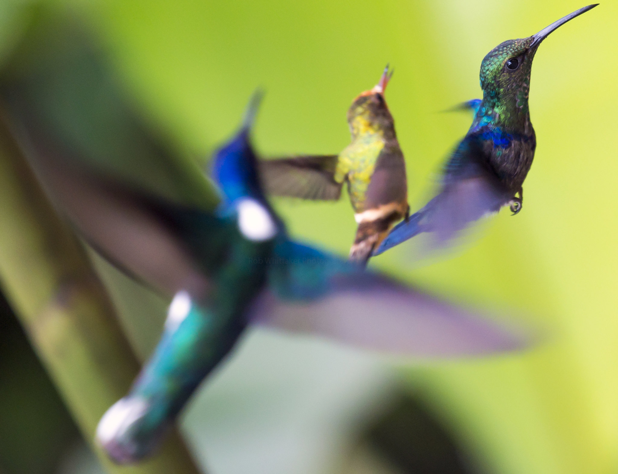
Peru Amazon tours offer an unforgettable opportunity to explore one of the most biodiverse regions on Earth, discover tropical rainforests, observe wildlife, visit remote rivers, and experience the natural and cultural richness of the Peruvian Amazon. From the wildlife-rich Tambopata National Reserve near Puerto Maldonado to the vast rainforest surrounding Iquitos and the protected wilderness of Manu National Park, travelers can choose from a wide range of jungle tours, guided expeditions, wildlife excursions, and multi-day Amazon adventures.
The best Peru Amazon tours combine knowledgeable local guides, comfortable jungle lodges, responsible wildlife observation, and carefully planned activities. Depending on your destination, budget, and available time, you can enjoy river excursions, rainforest hikes, canopy walks, macaw clay licks, visits to oxbow lakes, and opportunities to spot monkeys, tropical birds, caimans, and other Amazonian wildlife.
Whether you are searching for Peru Amazon tours from Cusco, jungle tours from Lima, affordable Amazon packages, or a premium rainforest experience, understanding the differences between destinations will help you choose the right adventure. This complete guide explains the best jungle trips in Peru, the most popular destinations, expected tour costs, package options, and essential factors to consider before booking.
Best Peru Amazon Tours and Jungle Experiences
The best Peru Amazon tours allow travelers to experience the rainforest through guided activities, wildlife observation, river exploration, and overnight stays in the jungle. Peru contains several distinct Amazonian environments, so the experience varies considerably depending on where you travel. Some destinations are particularly attractive for spotting macaws and monkeys, while others offer extensive river systems, remote rainforest trails, and opportunities to explore large protected areas.
Jungle tours in Peru generally range from short excursions lasting two days to longer expeditions of five days or more. Travelers can choose basic jungle lodges, comfortable eco-lodges, family-friendly packages, photography-focused trips, or specialized wildlife expeditions. Most organized tours include transportation from a nearby town, accommodation, meals, guided activities, and some combination of river journeys and rainforest walks.
What Makes the Best Peru Amazon Tours?
The best Peru Amazon tours balance wildlife opportunities, professional guiding, safety, accommodation, and responsible tourism. Rather than choosing a tour exclusively because it advertises the lowest price, consider how much time you will actually spend in the rainforest, which activities are included, and whether the itinerary provides opportunities to explore different habitats.
A quality Amazon tour should offer more than a quick visit to the jungle. Multi-day packages usually provide better opportunities to observe wildlife because different species are active at different times. Early mornings are particularly rewarding for birdwatching, while evening excursions may reveal nocturnal insects, frogs, and other rainforest animals.
Important features to compare include:
- Wildlife observation: Look for itineraries featuring rainforest walks, river excursions, birdwatching, and visits to suitable wildlife habitats.
- Experienced local guides: Knowledgeable guides can identify animal calls, explain rainforest ecology, and help visitors observe wildlife without disturbing it.
- Accommodation: Compare private bathrooms, mosquito protection, electricity, drinking water arrangements, and the level of comfort offered.
- Transportation: Check whether airport transfers, riverboat journeys, road transfers, and connections between towns and lodges are included.
- Meals and activities: Confirm which meals, excursions, entrance fees, and equipment are covered by the package.
- Responsible tourism: Prefer operators that respect wildlife, protect sensitive habitats, and work appropriately with local communities.
Popular Jungle Experiences in Peru
Peruvian Amazon rainforest tours offer activities for travelers with different interests and fitness levels. Some visitors prioritize photography and birdwatching, while others prefer hiking, canoeing, cultural learning, or relaxing in a lodge surrounded by tropical forest.
Rainforest Hiking and Nature Walks
Guided rainforest hikes introduce visitors to the remarkable plants, insects, trees, and animals of the Amazon. Guides often explain medicinal plant traditions, rainforest ecosystems, animal tracks, and the relationships between different species. Trails vary from relatively easy lodge walks to longer excursions over muddy, uneven terrain.
River Excursions and Canoe Trips
Rivers are essential transportation routes throughout the Amazon. Depending on the destination, tours may use motorized boats, canoes, or other small vessels to explore waterways, observe birds, and reach remote sections of the forest. River excursions can also provide opportunities to spot river turtles, caimans, and other aquatic wildlife.
Birdwatching and Macaw Clay Licks
Birdwatching is one of the most rewarding activities in the Peruvian Amazon. Colorful macaws, toucans, parrots, kingfishers, and numerous other tropical birds inhabit the region. Certain locations, particularly in the Tambopata area, are known for macaw clay licks where parrots and macaws gather to consume mineral-rich clay.
Canopy Walkways and Observation Towers
Some lodges offer elevated walkways or observation platforms that allow visitors to experience the rainforest canopy. These facilities provide a different perspective on the forest, making it easier to observe birds, insects, and vegetation in the upper layers of the ecosystem.
Night Walks and Nocturnal Wildlife
Night walks reveal a different side of the rainforest. With a trained guide and appropriate lighting, visitors may encounter tree frogs, spiders, katydids, nocturnal insects, and other animals that are difficult to observe during daylight. Wildlife sightings are never guaranteed, and visitors should follow the guide’s instructions throughout the excursion.
Peru Amazon Tours by Destination
Choosing the right destination is one of the most important decisions when planning Peru Amazon tours. Puerto Maldonado, Iquitos, and Manu offer different combinations of accessibility, landscapes, wildlife experiences, and accommodation styles.
Puerto Maldonado is a convenient gateway to the southern Amazon and Tambopata. Iquitos provides access to northern Amazonian rivers and rainforest reserves, while Manu is particularly attractive to travelers seeking extensive protected habitats and a more expedition-oriented experience.
Amazon Tours in Puerto Maldonado and Tambopata
Peru Amazon tours Puerto Maldonado are among the most convenient options for travelers who want to experience the southern Peruvian rainforest. Puerto Maldonado, the capital of Madre de Dios, serves as a gateway to jungle lodges, river excursions, wildlife reserves, and the famous Tambopata region.
Most tours begin in Puerto Maldonado and continue by road and boat to a lodge situated along a river or within the rainforest. The length of the journey depends on the lodge’s location. Some properties are relatively accessible, while others require longer boat transfers that take visitors deeper into the forest.
Peru Amazon Tours Tambopata: Wildlife and Rainforest Exploration
Tambopata is one of the most popular destinations for travelers interested in wildlife observation and tropical biodiversity. The region includes protected rainforest, river environments, lakes, and habitats that support an extraordinary variety of birds, mammals, reptiles, insects, and plants.
Peru Amazon tours Tambopata commonly include guided forest walks, boat rides, birdwatching, and visits to oxbow lakes. Depending on the itinerary, visitors may explore areas associated with macaw clay licks, where large numbers of parrots and macaws sometimes gather. Sightings vary according to weather, season, and local wildlife activity.
The wider Tambopata landscape is also associated with giant river otters, capybaras, caimans, monkeys, and numerous bird species. Although some animals are regularly encountered in suitable habitats, sightings of elusive species such as jaguars are unpredictable and should never be treated as a guaranteed feature of a tour.
What to Expect from a Puerto Maldonado Jungle Tour
A typical multi-day tour follows a schedule designed around travel time, weather, and wildlife activity. After arriving in Puerto Maldonado, visitors generally transfer to the river and continue to their lodge. Following lunch and an orientation, the first excursion may include a short forest walk or a boat trip.
The following days often combine early-morning wildlife observation, daytime rainforest hikes, lake excursions, and optional nighttime activities. Tours usually conclude with a boat journey back to Puerto Maldonado, followed by onward transportation to the airport or another destination.
Common activities include:
- Guided rainforest walks to learn about tropical plants and animal habitats.
- Boat excursions along rainforest rivers.
- Birdwatching and visits to suitable macaw clay-lick locations.
- Exploration of oxbow lakes and surrounding forest.
- Evening excursions focused on nocturnal wildlife.
- Canopy walks or observation platforms at participating lodges.
A three-day or four-day itinerary is often a useful starting point for visitors who want more than a brief introduction to the Amazon. Longer stays provide additional opportunities to explore different habitats and enjoy the lodge experience without rushing between activities.
Who Should Choose Tambopata?
Tambopata is especially suitable for wildlife enthusiasts, photographers, couples, families with appropriate tour arrangements, and travelers visiting Peru who want to combine the rainforest with Cusco or Machu Picchu. Its relatively straightforward access from Puerto Maldonado makes it a practical option for travelers with limited vacation time.
Amazon Tours in Iquitos
Peru Amazon tours Iquitos offer access to the northern Peruvian Amazon, a region characterized by enormous river systems, flooded forests, remote communities, and extensive tropical habitats. Iquitos is an important regional city that can be reached by air or by river, rather than by a continuous conventional road connection from the rest of Peru.
Iquitos is an excellent starting point for travelers who want to experience the Amazon River and its tributaries, stay at rainforest lodges, or explore protected areas in the surrounding region. Tour itineraries may involve motorized boats, guided walks, visits to designated reserves, and excursions through waterways bordered by dense vegetation.
Iquitos Peru Amazon Tours: Activities and Experiences
Iquitos Peru Amazon tours vary considerably according to the lodge, reserve, and river system visited. Some packages focus on comfortable lodge stays with daily excursions, while others emphasize river journeys and longer expeditions into less accessible areas.
Wildlife observation may include monkeys, tropical birds, sloths, caimans, and river-associated species. The surrounding environment also supports pink river dolphins, although encounters are not guaranteed. Visitors should choose operators that observe appropriate wildlife-viewing practices and do not encourage harmful interactions with animals.
Popular activities include:
- Exploring rainforest trails with a naturalist guide.
- Traveling along Amazonian rivers and smaller tributaries.
- Observing birds and other wildlife from boats.
- Learning about regional plants and traditional ecological knowledge.
- Visiting designated conservation areas where access is permitted.
- Experiencing the sounds and scenery of the rainforest after dark.
Some tours also incorporate community visits or cultural activities. These should be organized respectfully, with appropriate local participation and clear information about what visitors can expect.
How Many Days Do You Need in Iquitos?
A three-day itinerary can provide a useful introduction to the northern Amazon, while four- to six-day trips offer more time for river excursions, wildlife observation, and relaxation. Longer expeditions may be appropriate for travelers interested in remote locations or specialized wildlife experiences.
When comparing Iquitos packages, check the actual location of the lodge. A package advertised as an Amazon jungle tour may spend considerable time near the city, whereas another may involve several hours of river travel to reach a more remote setting.
Manu Amazon Tours
Manu Peru Amazon tours are ideal for travelers interested in protected rainforest, ecological diversity, and guided exploration of one of Peru’s most important conservation landscapes. Manu National Park and the surrounding biosphere reserve contain a range of ecosystems, from Andean environments to lowland tropical rainforest.
The Manu region is particularly attractive to birdwatchers, naturalists, photographers, and travelers who prefer a more expedition-oriented experience. Access and permitted activities depend on the specific area being visited, and not every tour enters the national park’s most restricted zones.
Wildlife and Biodiversity in Manu
Manu supports an exceptional variety of tropical species, including macaws, monkeys, tapirs, capybaras, giant otters in suitable habitats, and numerous amphibians and reptiles. Its combination of elevations and habitats contributes to its ecological richness.
Guided tours may include rainforest hikes, river journeys, birdwatching, wildlife observation from designated viewpoints, and visits to authorized areas. Some itineraries travel through cloud forest before descending toward the lowland Amazon, creating opportunities to observe changes in vegetation and wildlife.
Nevertheless, wildlife sightings depend on many factors, including weather, seasonal movements, habitat conditions, and the behavior of individual animals. A responsible itinerary emphasizes understanding the ecosystem rather than promising encounters with specific species.
Manu Tours from Cusco
Many Manu expeditions depart from Cusco and travel by road through mountain landscapes and cloud forest before continuing into the Amazonian lowlands. Depending on the itinerary, this journey can be a major part of the experience.
Travelers should pay attention to driving times, road conditions, accommodation arrangements, and the number of nights actually spent in the rainforest. A longer itinerary usually allows a more relaxed experience than a short trip dominated by transportation.
Manu is particularly suitable for visitors who have several days available and want to focus on natural history, conservation, and biodiversity. Those with only two or three days may find a more accessible destination easier to manage.
Peru Amazon Tours from Cusco and Lima
Peru Amazon tours from Cusco and Lima make it possible to include a rainforest adventure in a wider Peru vacation. The best departure city depends on your existing itinerary, flight connections, budget, and the type of Amazon experience you want.
Cusco is a convenient starting point for travelers exploring the Andes, while Lima provides access to domestic flights connecting with major Amazon gateways. In either case, it is important to distinguish between the time needed to reach the Amazon and the time spent exploring the rainforest itself.
Amazon Tours from Cusco
Peru Amazon tours from Cusco are popular among travelers combining Machu Picchu, the Sacred Valley, and the Amazon rainforest in one trip. Cusco offers access to both Puerto Maldonado and Manu itineraries, although these involve different transportation arrangements and experiences.
For many travelers seeking a classic rainforest lodge experience, flying from Cusco to Puerto Maldonado is a practical option when suitable flights are available. After arriving, visitors usually continue by road and boat to their accommodation in or near Tambopata.
Peruvian Amazon tours from Cusco can also focus on Manu, especially for visitors interested in overland expeditions, cloud forest habitats, and biodiversity. These tours typically require more road travel and several days to explore the region properly.
Choosing Between Tambopata and Manu from Cusco
Tambopata is generally attractive for travelers seeking a relatively accessible jungle trip with opportunities for river excursions, birdwatching, and rainforest walks. Manu is better suited to visitors interested in a longer expedition across diverse ecological zones and a more extensive conservation landscape.
When choosing between the two, consider:
- Available time: Shorter trips are often easier to organize around Puerto Maldonado.
- Travel style: Tambopata commonly emphasizes lodge-based excursions, while many Manu itineraries involve longer overland journeys.
- Main interests: Compare wildlife observation, birdwatching, forest walks, and the habitats included.
- Comfort preferences: Check accommodation standards, road travel, boat transfers, and daily schedules.
- Total cost: Include flights, ground transportation, meals, entrance fees, and additional nights in Cusco.
Travelers should also allow sufficient time between their Amazon tour and important international departures. Weather, transportation delays, and changes to flight schedules can affect connections.
Amazon Tours from Lima
Peru Amazon tours from Lima are a practical choice for visitors beginning their vacation in the capital or connecting from international flights. Lima has domestic flight connections to several cities that serve as gateways to the Amazon, including Iquitos and Puerto Maldonado, subject to available schedules.
Travelers can fly from Lima to Iquitos for northern Amazon river and lodge experiences or to Puerto Maldonado for access to Tambopata. Manu trips may require a connection to Cusco or a separately arranged overland itinerary.
Planning a Lima-to-Amazon Itinerary
A convenient itinerary typically begins with an overnight stay in Lima when required by international flight arrival times, followed by a domestic flight to the chosen Amazon gateway. Depending on the tour, visitors may continue to their lodge on the same day or spend a night in the gateway city before departing.
For a short vacation, a three- or four-day Amazon package can provide a balanced introduction to rainforest wildlife and scenery. Travelers with additional time may combine the jungle with Cusco, Machu Picchu, Lake Titicaca, or other destinations in Peru.
When booking Peru Amazon tours from Lima, compare the total travel time rather than just the advertised tour duration. A package described as three days may include significant transfer time, leaving fewer hours for guided rainforest activities.
Peru Amazon Tours Cost and Packages
The peru amazon tours cost depends on the destination, trip duration, lodge category, transportation, group size, included activities, and season. Budget-friendly tours may use simpler accommodation and shared transportation, while premium packages may feature private rooms, smaller groups, specialized guides, and more elaborate meals or excursions.
As a general planning estimate, multi-day Amazon tours in Peru can range from approximately $150 to $300 per person for some basic short packages, $300 to $700 for many standard multi-day experiences, and $700 to $1,500 or more for selected premium or longer itineraries. These are indicative budgeting ranges, not verified current quotations; actual prices vary significantly by operator, destination, and inclusions.
Average Peru Amazon Tour Prices
| Tour type | Indicative price per person |
|---|---|
| Basic two-day jungle tour | $150–$300 |
| Standard three-day Amazon package | $250–$500 |
| Four-day rainforest experience | $350–$700 |
| Premium lodge package | $700–$1,500+ |
| Longer or specialized expedition | $800–$2,000+ |
These ranges are illustrative and can overlap. They should not be interpreted as fixed market prices or guarantees that a particular package is available at the stated amount.
What Is Included in an Amazon Tour Package?
Most organized Amazon tours include accommodation, meals during the itinerary, guided excursions, and some transportation from the designated departure point. However, the exact inclusions differ substantially between operators.
Before booking, verify whether the following are included:
- Airport pickup and return transfer.
- Road transportation and riverboat transfers.
- Lodge accommodation and meals.
- English-speaking or multilingual guides.
- Entrance fees and authorized activity fees.
- Equipment for scheduled excursions.
- Drinking water during the trip.
- Any domestic flights or overnight stays before or after the tour.
Domestic flights are often separate from the advertised jungle package, particularly when the operator begins the tour in Puerto Maldonado, Iquitos, or Cusco. Travel insurance, personal expenses, tips, and optional activities may also cost extra.
Budget, Standard, and Premium Jungle Packages
Budget Amazon Tours
Budget tours are suitable for travelers who prioritize affordability and basic rainforest activities. These packages may use simpler lodges, shared transfers, and group excursions. They can still offer valuable wildlife and nature experiences, provided the itinerary is well organized and the operator follows appropriate safety practices.
When evaluating a low-cost tour, check the accommodation location, transfer times, number of guided excursions, and meal arrangements. A low initial price may not represent good value if essential activities or transportation are excluded.
Standard Amazon Tour Packages
Standard packages typically balance comfort, guided activities, and price. They may include private rooms, scheduled boat excursions, guided forest walks, and several meals each day.
For many first-time visitors, a three- or four-day standard package is a practical choice because it allows time to explore the rainforest without requiring a luxury budget or an extended vacation.
Luxury Amazon Tours
Premium packages emphasize comfort, personalized service, and distinctive lodge settings. Depending on the property, features may include upgraded rooms, private guides, specialized wildlife excursions, and more flexible schedules.
Luxury does not necessarily mean more wildlife sightings. Animal encounters depend on habitat, timing, and natural behavior, so travelers should evaluate the quality of the itinerary rather than assuming a higher price guarantees better wildlife viewing.
How to Save Money on Peru Amazon Tours
Travelers can manage their Amazon tour budget by choosing a destination that fits their itinerary, comparing complete package inclusions, and selecting a trip length that offers good value.
Practical strategies include:
- Compare the total price rather than the advertised starting rate.
- Check whether flights, transfers, meals, and entrance fees are included.
- Consider joining a small group instead of booking a private tour.
- Travel with enough flexibility to accommodate domestic flight schedules.
- Choose a lodge that matches your priorities instead of paying for facilities you will not use.
- Book with enough time to compare itineraries, cancellation terms, and accommodation details.
It is also worth considering the cost of spending an additional night in the gateway city. A slightly more expensive package with convenient transfers may offer better overall value than a cheaper tour requiring extra hotel nights or complicated transportation.
How to Choose the Best Amazon Tour in Peru
Finding the best Peru Amazon tours requires more than comparing photographs and prices. The right tour should match your interests, available time, comfort expectations, and travel budget while providing a responsible way to experience the rainforest.
Begin by identifying the type of adventure you want. Travelers interested in colorful birds and wildlife photography may prioritize Tambopata, while visitors seeking northern Amazon river environments may prefer Iquitos. Those interested in protected wilderness and ecological diversity may find Manu particularly appealing.
Choose the Right Destination for Your Interests
Your destination should reflect the experience you want rather than simply the most frequently advertised package.
- For accessible rainforest lodge trips: Consider Puerto Maldonado and Tambopata.
- For Amazon River landscapes: Consider Iquitos and the northern Amazon.
- For extensive ecological exploration: Investigate authorized Manu itineraries.
- For a trip combined with Machu Picchu: Compare flight connections from Cusco to Puerto Maldonado.
- For a vacation beginning in Lima: Compare domestic connections to Iquitos and Puerto Maldonado.
Remember that each destination contains different habitats, and no single location offers every Amazon wildlife experience.
Compare Itineraries and Accommodation
A detailed itinerary should identify departure times, transportation methods, planned activities, accommodation, and return arrangements. Be cautious of descriptions that list many attractions without explaining how much time is allocated to each activity.
Ask whether excursions are conducted in small groups, how guides handle wildlife sightings, and what happens when heavy rain or river conditions require changes. Good operators should explain the practical limitations of the environment rather than guaranteeing unrealistic results.
Accommodation standards also deserve attention. Verify room types, bathroom arrangements, mosquito protection, electricity availability, and whether hot water or reliable internet access is provided if these features matter to you.
Evaluate Wildlife and Safety Practices
Responsible wildlife observation should be a central consideration when choosing an Amazon tour. Guides should maintain appropriate distances from animals, avoid unnecessary disturbance, and follow local regulations in protected areas.
Ask about first-aid arrangements, emergency communication, boat safety equipment, and procedures for responding to severe weather or medical problems. Travelers should also disclose relevant mobility limitations or dietary requirements before confirming a booking.
Understand Seasonal Conditions
The Amazon rainforest has a tropical climate, with rainfall, river levels, humidity, and wildlife activity varying throughout the year. Higher river levels can improve access to some flooded-forest environments, while lower water levels may expose trails and riverbanks that are less accessible during wetter periods.
Neither season is universally best. The ideal time depends on whether you prioritize hiking, canoeing, birdwatching, photography, or access to particular locations. Confirm local conditions with the tour operator before choosing travel dates.
Peru Amazon Tours Reviews: What Travelers Should Check
Peru Amazon tours reviews can help travelers compare operators, understand accommodation standards, and identify differences between advertised itineraries and actual experiences. However, reviews should be evaluated carefully because individual expectations, weather conditions, wildlife sightings, and group dynamics can influence the overall rating.
Look for detailed accounts from travelers who visited the same destination, stayed at the same lodge, or booked a similar tour duration. A review describing a four-day Tambopata expedition may not accurately represent a two-day tour near Iquitos.
How to Evaluate Amazon Tours Peru Reviews
Useful reviews describe specific aspects of the trip rather than simply saying that the experience was excellent or disappointing. Pay attention to comments about guide knowledge, transportation reliability, meal quality, cleanliness, communication, and the amount of time spent on activities.
Consider these questions when reading reviews:
- Did the tour follow the advertised itinerary?
- Were transportation arrangements clear and reliable?
- Did the guide explain wildlife, plants, and local ecosystems?
- Was the accommodation consistent with the description?
- Were meals and dietary requirements handled appropriately?
- Were additional fees explained before departure?
- Did the operator respond professionally to problems?
- Were wildlife encounters described realistically?
A pattern of consistent feedback across multiple recent reviews is generally more informative than one unusually positive or negative account.
Recognizing Unreliable Reviews
Be cautious of reviews that contain very little detail, repeat identical wording, or make extraordinary promises about guaranteed wildlife sightings. Also examine negative reviews for context. A complaint about heavy rain may reflect normal rainforest conditions, whereas repeated complaints about missing transfers or undisclosed charges may indicate a more serious operational problem.
The most useful reviews distinguish between factors the operator can control and natural conditions that cannot be guaranteed.
Frequently Asked Questions About Peru Amazon Tours
What Are the Best Peru Amazon Tours?
The best Peru Amazon tours depend on your interests, available time, and budget. Puerto Maldonado and Tambopata are strong choices for accessible rainforest lodge experiences and wildlife observation. Iquitos offers northern Amazon river environments, while Manu is attractive for travelers interested in extensive protected landscapes and biodiversity.
Compare the itinerary, guide experience, accommodation, transportation, and activities before deciding which tour best suits your needs.
How Much Do Peru Amazon Tours Cost?
Prices vary by destination, duration, accommodation, and inclusions. As a broad planning estimate, some basic two-day packages may cost around $150–$300 per person, while standard three- or four-day experiences may range from approximately $250–$700. Premium lodges and longer expeditions can cost $700–$1,500 or more.
These figures are indicative rather than current confirmed offers. Always request a detailed quotation and verify whether flights, transfers, entrance fees, and meals are included.
How Many Days Should I Spend in the Amazon Rainforest?
Three or four days is a useful starting point for many first-time visitors. This duration can allow time for transportation, guided rainforest walks, river excursions, and wildlife observation without requiring an extended vacation.
Two-day trips are possible for travelers with limited time, although the experience may involve more transportation relative to time spent exploring. Longer stays are useful for remote destinations and specialized wildlife interests.
Is Puerto Maldonado or Iquitos Better for an Amazon Tour?
Both destinations offer valuable rainforest experiences, but they provide different settings. Puerto Maldonado is a convenient gateway to Tambopata in the southern Amazon, with lodge-based excursions and opportunities for birdwatching and wildlife observation.
Iquitos provides access to northern Amazon river systems, flooded forests, and surrounding rainforest reserves. Your existing itinerary, preferred activities, and transportation options should guide the decision.
Can I Take Peru Amazon Tours from Cusco?
Yes. Travelers can organize Amazon tours from Cusco, particularly to Puerto Maldonado and Tambopata when suitable flights are available. Overland expeditions to Manu are another option, although these generally require more travel time.
Allow enough time for transfers and avoid scheduling an international departure immediately after a remote jungle expedition.
Are There Amazon Tours from Lima?
Yes. Lima connects with Amazon gateway cities such as Iquitos and Puerto Maldonado through domestic flights, depending on available schedules. Travelers can arrange tours departing from either destination and select a package based on the length of their vacation.
Remember to account for airport transfers, overnight stays, and the time needed to reach the lodge.
What Should I Pack for an Amazon Jungle Tour?
Pack lightweight, breathable clothing, long-sleeved shirts, long trousers, comfortable walking shoes, a rain jacket, insect repellent, sunscreen, a hat, and a reusable water bottle where appropriate. Waterproof bags can protect electronics and important belongings during boat transfers.
A headlamp, binoculars, and a small daypack can also be useful. Check with your operator about recommended footwear, laundry arrangements, and any specialized equipment needed for planned activities.
Is the Peruvian Amazon Safe for Tourists?
Many travelers visit the Peruvian Amazon on organized tours, but safety depends on appropriate planning, experienced guides, reliable transportation, and respect for local conditions. Visitors should follow instructions during boat journeys and forest walks, avoid approaching wildlife, and use recommended protection against insects.
Before booking, ask about emergency procedures, first-aid arrangements, boat safety, and the guide’s experience. Travelers should also review current travel advice and consult a healthcare professional about destination-specific precautions before departure.
When Is the Best Time to Visit the Peruvian Amazon?
The Amazon can be visited throughout the year, but seasonal rainfall and river levels affect the experience. Higher water levels can improve access to flooded forests and certain waterways, while lower water levels may make some trails and riverbanks easier to access.
The best time depends on your destination and activities. Check the expected local conditions for Puerto Maldonado, Iquitos, or Manu rather than assuming the entire Amazon follows the same seasonal pattern.
Are Amazon Tours Suitable for Families?
Many lodges offer family-friendly experiences, but suitability depends on the children’s ages, transfer duration, accommodation, walking requirements, and available safety arrangements. Families should ask about minimum ages for excursions, life jackets, meal options, and activities adapted for children.
A lodge with relatively straightforward access and a flexible itinerary may be preferable to a remote expedition involving long road and boat journeys.
Do Amazon Tours Guarantee Wildlife Sightings?
No responsible operator can guarantee sightings of wild animals. The rainforest is a natural environment, and wildlife activity changes according to weather, season, habitat, and animal behavior.
Choosing a knowledgeable guide and allowing several days for exploration can improve opportunities to observe wildlife, but even well-planned expeditions may not encounter particular species.
What Is Usually Included in a Peru Amazon Tour Package?
Packages commonly include lodge accommodation, meals during the itinerary, guided excursions, and designated transportation from a gateway city. Some tours also include entrance fees, equipment, and additional activities.
Always verify the exact inclusions in writing. Flights, personal expenses, tips, travel insurance, and accommodation before or after the tour may be excluded.
Final Thoughts: Planning Your Peru Amazon Adventure
Peru Amazon tours provide an exceptional way to discover tropical rainforest, observe wildlife, explore rivers, and learn about one of the world’s most important natural environments. The best destination depends on the experience you want: Tambopata and Puerto Maldonado are convenient options for wildlife-focused lodge stays, Iquitos offers access to the northern Amazon’s extensive waterways, and Manu appeals to travelers seeking diverse ecosystems and more expedition-oriented exploration.
Before booking, compare itineraries, realistic travel times, accommodation standards, guide experience, and the complete package cost. Read detailed reviews, verify important information directly with the operator, and choose a tour that emphasizes responsible wildlife observation and respect for local communities.
With the right planning, a well-organized Amazon journey can become one of the most memorable parts of a trip to Peru, whether you have only a few days available or enough time for a longer rainforest expedition.