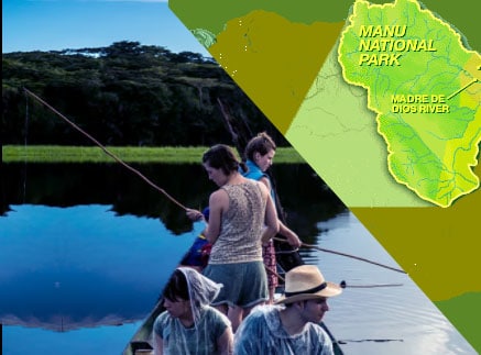
Manu map and location
The Manu is divided into three zones: the largest sector is the natural zone, which comprises 80{c0703f7f9c2066f1973534d24c719b55597fc2c19666777f4898692757df1612} of the total area of the park and is closed for unauthorized visitors. The second sector, even within the natural park itself, is the reserved area, where only controlled research and tourism activities are allowed. The third sector, which covers the southeast area, is the cultural area, where most of the activity of the visitors is concentrated.
The largest area A is the core zone, the National Park, which is strictly conserved in its natural state. Zone B is a Buffer Zone, generally known as a Reserved Zone for controlled research and tourism activities. Zone C is the Transition or Cultural Zone, an area of human settlement for controlled traditional use. Accessible only by boat, due to the temperamental environment of the jungle; the region experiences a rainy season from December to March, and it is best visited between May and August, when it is much drier, although at that time the temperatures often exceed 32 ° C (89 ° F).
The Manu National Park is located in the provinces of Paucartambo in Cusco and Manú in Madre de Dios. Its extension is 1716295.20 hectares. Its establishment seeks to protect a representative sample of the biological diversity, as well as the nature of the low jungle, of the jungle and of the Andes of the Peruvian south-east.
In Manu, one of the most important areas of the planet is protected in terms of the mega diversity of biological species. Its great extension crosses frigid punas that surpass the 4,000 m.s.n.m; wild forested mountains that give rise to a multitude of small gorges and valleys; cloud forests of high forest and finally the Amazon plain. This magnificent and unique scenario includes a wide and complex hydrographic system and guarantees the presence of a diversity of ecosystems little intervened by man.
In these circumstances the biological diversity that houses the Manu is manifested in its full potential in a unique landscape of the planet. The tropical forests of the Manu have allowed the ecological and evolutionary processes to be carried out almost without the presence of man, in the zone there is also an enormous cultural richness, represented by the current indigenous populations in different levels of contact with the outside, and a heritage archaeological not yet revealed.
Since 1977 the Manu has the status of a Biosphere Reserve, which was granted by UNESCO. On its borders is the Territorial Reserve of the Kugapakori and Nahua ethnic groups, the Megantoni National Sanctuary and the Amarakaeri Communal Reserve. In 1987 it was declared a Natural Heritage of Humanity.
Much of the Manu is indigenous territory. The communities of the Yora, Mashko-Piro, Matsiguenka, Harakmbut, Wachipaeri and Yine inhabit ancestrally between the forests and rivers of these jungles. The native communities of Tayakome and Yomibato are recognized within the area. Both are located in the upper area of the Manu River. In the southwest sector there is an association of farmers known as Callanga. In addition, in the northwest sector adjacent to Manu there is an undetermined number of indigenous populations in voluntary isolation.